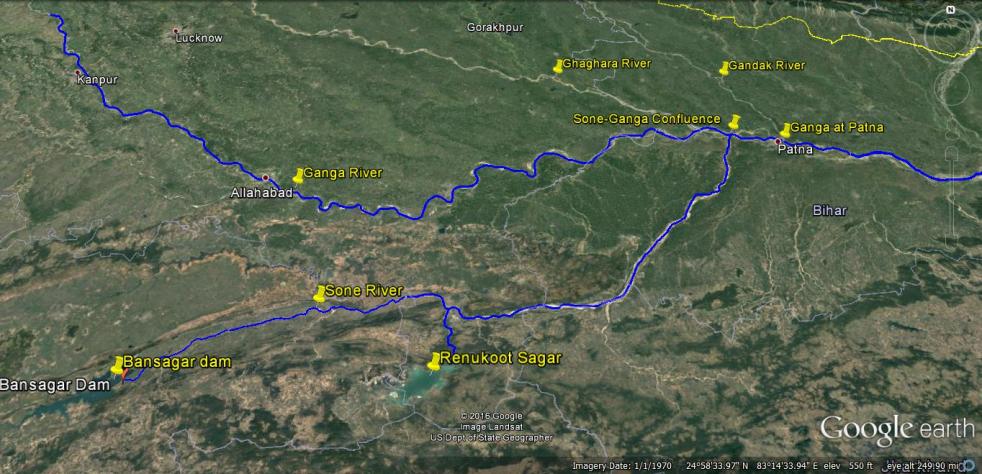
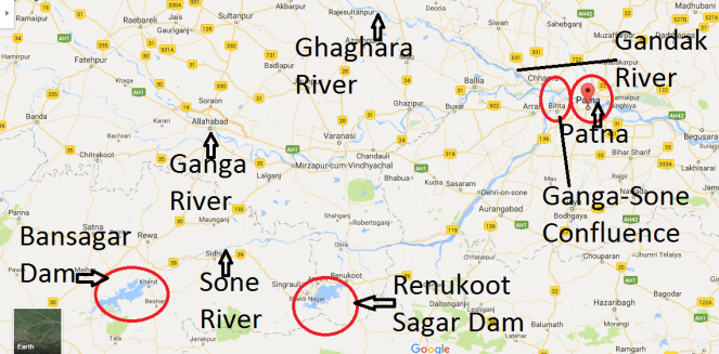
Above: Map Showing the location of Bansagar Dam, Sone River, Ganga River and Patna
Water level of Ganga at Patna reached 50.43 m on Aug 21, 2016 morning with still showing rising trend. This level was already 16 cm higher than the highest ever recorded flood level (HFL) of Ganga at Patna of 50.27 m. By Aug 22, 2016, at three more sites along Ganga, the water level had already breached the highest recorded levels: Balia in Uttar Pradesh (Ganga Water level at 60.3 m, higher than the HFL of 60.25 m recorded on Sept 14, 2003), Hathidah in Bihar (Ganga water level at 43.17 m, higher than the HFL of 43.15 m recorded on Aug 7, 1971, that is 45 years back) and Bhagalpur in Bihar (Ganga water level at 34.55 m, higher than HFL of 34.5 m recorded on Sept 3, 2013). This means that the highest flood level that started at Patna is now travelling both upstream and downstream along Ganga.
Several districts of Bihar along Ganga are facing floods, with at least 10 lakh people affected and about 2 lakh people displaced. On Aug 21 alone, NDRF teams have rescued over 5300 people from Didarganj, Bakhtiyarpur, Danapur Chhapra, Vaishali and Maner. At least ten lakh people have been affected in Bihar, two lakh have been displaced and scores have been killed. It seems more like and annual natural calamity.
But that is not the case, if we look closely. Available information shows that the unprecedented floods that we are now seeing in Ganga in Bihar and UP are largely due to contribution of two dams: Bansagar Dam along Sone river in Madhya Pradesh in the upstream and Farakka Dam (misleadingly called a Barrage) on the Ganga river in West Bengal. If Bansagar Dam was operated in optimum way, than it need not have released over ten lakh cusecs of water. As pointed out by Bihar government, the high floods brought by Ganga in Patna are majorly due to the high flow contributed by Sone river upstream of Patna.

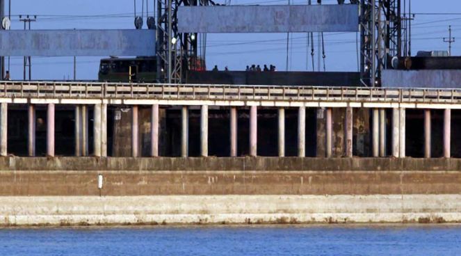
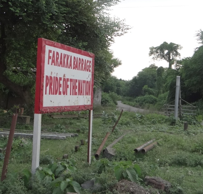
Role of Farakka The Farakka is the second dam that has contributed to the high floods in Bihar, as pointed out by Bihar Chief Minister Shri Nitish Kumar. In fact, due to opening of some of the gates of Farakka, as reported by NDTV[i] (NDTV reported that 104 gates were opened on Aug 21 evening, but this is yet to be ascertained since this could create major disaster in the downstream areas), the Ganga water level at Gandhi Ghat came down to 50.11 m by Aug 22 evening from the unprecedented level of 50.43 m on Aug 21. Bihar Chief Minister has said, consistent with what he has been saying over the last few years, that Farakka barrage has led to drainage congestion in the upstream, has led to increase in Ganga river bed level in upstream areas and also has reduced the carrying capacity of the river. He has been asking for an independent review of the usefulness of Farakka barrage and demanding decommissioning of the barrage. He has also rightly asked for National Silt Management Policy, there is none today. These are very legitimate demands of Bihar Chief Minister, which he has been raising earlier too, including recently in front of the Prime Minister, but it seems the central government is not listening.
Opening of the Farakka gates have created flood disaster in Malda in West Bengal and further downstream.
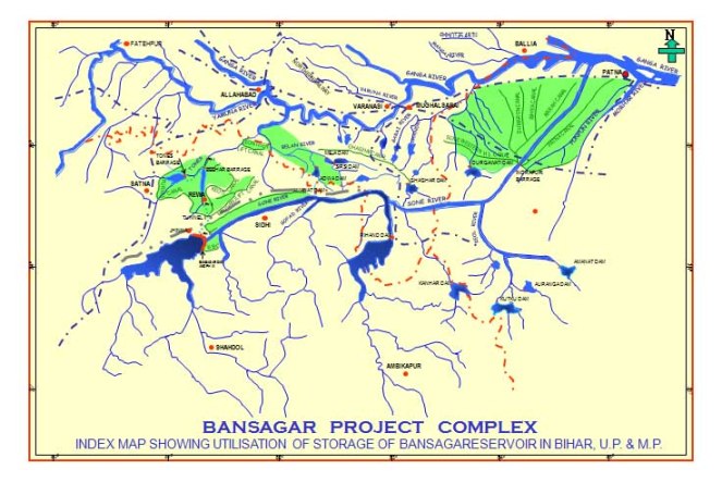
Mismanaged Operation of Bansagar Dam Available information on website of Madhya Pradesh Water Resources Department[ii] shows that the Bansagar Dam on Sone river in Shahdol district of Madhya Pradesh with Full Reservoir Level (FRL) of 341.64 m has Live Storage Capacity of 5429.6 MCM (Million Cubic Meters). This is the third highest capacity reservoir of Madhya Pradesh (after Indira Sagar on Narmada and Gandhi Sagar on Chambal) and such reservoirs should only be filled up closer to the end of the monsoon and in case need to be operated in such a way during the monsoon that when downstream area is getting high rainfall, or facing floods, the reservoir does not have to release water to add to the downstream flood disaster. However, by 0800 hours in the morning of Aug 19, 2016, the water level at the dam was already 341.33 m, which means with storage of 5169.2 MCM, the reservoir was 95.22% full and had very little capacity to store more water. However, till the evening (1730 hours) of 1808, the dam was releasing about 1672 cumecs (cubic meters per second), much lower than the inflows. It was only at 0700 hours in the morning of Aug 19 that the dam started releasing massive 15798 cumecs of water, opening 16 of its 18 gates. It is this release of water, added to the downstream heavy rainfall, that led to Ganga river water reaching unprecedented levels in Patna and elsewhere in Bihar and UP. If Bansagar dam had not released water during this period of floods in the downstream area, by not filling up the dam earlier, the unprecedented flood levels in Bihar and UP could have been avoided, and with it the floods that lakhs of people faced.
Often when we raise the question about advance water release from dams to ensure that dams continue to have cushion to avoid creating downstream flood disaster, we are asked about the risk of loss of water in case there are no rains subsequently. However, that is not the case this year when monsoon is already surplus in East Madhya Pradesh, Bansagar catchment of 18648 sq km upstream of the dam. This becomes particularly important when it is known that there is over 50 000 sq km of catchment below the dam. Moreover, there was also advance warning from IMD of the impending high rainfall in East MP. Clearly, actionable information was available for advance release of water from the Bansagar dam, but this was not heeded till 0700 hours on Aug 19, 2016, after which suddenly large quantity of water was released when downstream areas were already facing high rainfall and floods. Even as I write this around noon on Aug 23, 2016, another such release from Bansagar Dam is impending as the water level at the dam has already reached 340.92 m (close to 90% live storage capacity by 0800 hours today with all gates closed.
More over, when the Bansagar reservoir filling started on June 25, 2016, the dam already had 1808.58 MCM of water. It may be recalled that 2015-16 was a drought year and yet, over 33.3% of the live storage in Bansagar reservoir remained unutilized at the end of the 2015-16 drought year! In fact if this water had been put to use in the drought year, it would have been doubly beneficial: It would have created additional space of over 1800 MCM in the reservoir and water stored this monsoon to that extent would have created that much lower flood disaster in the downstream area.

Even hydropower generation at the 405 MW installed capacity at the three stage hydro projects in 2015-16 was 721.84 MU, almost half of the generation of 1388.5 MU in the previous year (in fact the generation of 1388.5 MU in 2014-15 itself was about 30% lower than the generation of about 1931 MU during previous two years) as per official figures from Central Electricity Authority[iii]. Even during the first four months (April-July) of current financial year (2016-17), hydropower generation at Bansagar hydro station was already lower at 161.13 MU compared to 299.05 MU during the same period previous year, which itself was lower than the earlier two years! This is another major loss for economy, but why was this the case?
All this leads to a number of questions:
- WHY WAS THE BANSAGAR DAM ALLOWED TO FILL UP TO 96% LEVEL BY 0700 HOURS ON AUG 19, 2016, WHEN ACTIVE MONSOON FOR AT LEAST SIX MORE WEEKS REMAINED?
- WHY WAS MORE WATER NOT RELEASED EARLIER SO THAT SUDDEN SPIKE IN RELEASE THAT STARTED AT 0700 HOURS ON AUG 19 COULD HAVE BEEN AVOIDED?
- WHO IS RESPONSIBLE FOR CREATING THIS MAN MADE DISASTER IN BIHAR AND UP THAT COULD HAVE BEEN AVOIDED WITH MORE PRUDENT MANAGEMENT OF BANSAGAR PROJECT? WHAT ACTION HAS BEEN TAKEN IN THIS REGARD?
- IS THERE A RULE CURVE FOR BANSAGAR RESERVOIR FILLING? IS IT BEING FOLLOWED? WHO ARE RESPONSIBLE FOR NOT FOLLOWING IT? WHY IS THIS RULE CURVE NOT IN PUBLIC DOMAIN? WHY IS THERE NO INFORMATION ABOUT THIS ON THE BANSAGAR CONTROL BOARD WEBSITE? WHY IS THERE NO TRANSPARENT AND ACCOUNTABLE RESERVOIR OPERATION MECHANISM FOR BANSAGAR DAM?
- WHY WAS OVER 1800 MCM OF WATER REMAIINED UNUTILISED IN THE BANSAGAR DAM EVEN IN A DROUGHT YEAR? WHO IS RESPONSIBLE FOR THIS SUB OPTIMAL USE OF THE RESERVOIR? WHY WAS THE POWER GENERATION AT BANSAGAR PROJECT SO LOW DURING 2015-16 WHEN SO MUCH WATER WAS STILL AVAILABLE AT THE END OF THE YEAR?
- WHAT ACTION HAS THE MADHYA PRADESH GOVERNMENT TO INVESTIGATE THIS FAILURE AT THE BANSAGAR DAM AND HOLD THOSE RESPONSIBLE ACCOUNTABLE?
- WHAT STEPS HAVE OTHER STATES, NAMELY UP AND BIHAR, WHO ARE PART OF THE INTERSTATE BODY BANSAGAR CONTROL BOARD[iv], CREATED SPECIFICALLY FOR BANSAGAR PROJECT?
- WHAT STEPS HAS UNION WATER RESROUCES MINISTER AS CHAIRPERSON OF THE BANSAGAR CONTROL BOARD TAKEN?
- WHAT HAS CENTRAL WATER COMMISSION DONE IN THIS REGARD? IT MAY BE MENTIONED HERE THAT CHAIRMAN OF CWC IS THE EX OFFICIO CHAIRMAN OF EXECUTIVE COMMITTEE OF BANSAGAR CONTROL BOARD, CREATED IN 1976 AFTER THE INTERSTATE AGREEMENT IN 1973.

In Conclusion It is clear from the above that mismanagement at Bansagar Dam and the drainage congestion and siltation in Ganga created by the Farakka dam have together created an avoidable flood disaster this year in Bihar and now in Uttar Pradesh. This disaster is likely to be prolonged one, it seems, since another high rainfall wave is just passing through the areas of East Madhya Pradesh, Bihar and UP.
On the issue of mismanagement at Bansagar project, only an independent enquiry can answer these questions. Unfortunately, we have not been conducting such inquiry, nor fixing accountability for such mismanagement. This is clearly an invitation for more such disasters.
On Farakka, we need to urgently institute an independent review of usefulness of the Farakka barrage, its costs, benefits and impacts in the upstream and downstream. The review must look into all options including operational and structural decommissioning of the barrage.
We also need to pay heed to the demand by Bihar Chief Minister about need for a silt management policy. Today we do not seem to understand or appreciate the role silt and sediment plays in the functioning of our rivers and river basins. This neglect is playing havoc with our rivers and also river basins, right upto fertile plains and deltas, which are shrinking and sinking due to silt not reaching the deltas. So while deltas are deprived of silt that is necessary for their survival, the same silt and sand is creating havoc in the upstream riverbeds and reservoirs.
One hopes we do justice to all these issues. These issues are only getting more urgent in changing climate situation.
Himanshu Thakkar (ht.sandrp@gmail.com), SANDRP
EARLIER SANDRP BLOGS ON FARAKKA:
- https://sandrp.wordpress.com/2014/11/25/lessons-from-farakka-as-we-plan-more-barrages-on-ganga/
- https://sandrp.wordpress.com/2014/09/29/world-rivers-day-and-ganga-a-look-at-farakka-barrage-and-other-such-calamities/
- https://sandrp.wordpress.com/2016/08/12/sushri-umaji-hilsa-fisherfolk-and-ganga-deserve-more-than-a-fish-ladder-by-cifri/
- https://sandrp.wordpress.com/2016/08/11/impacts-of-ganga-waterways-plan-on-its-ecology-and-the-people/
- https://sandrp.wordpress.com/2014/06/27/ganga-in-peril-building-more-barrages-will-finish-it-off/
END NOTES:
[i] http://www.ndtv.com/india-news/as-bihar-floods-nitish-kumar-warns-centre-send-impartial-experts-1446648?pfrom=home-lateststories
[iii] http://www.cea.nic.in/reports/monthly/generation/2016/March/actual/opm_16.pdf
[iv] http://bcb.nic.in/index.html
Also explore the link to see Hindi version of this report

Very good and timely report. But is anyone sitting in authority listening?
Dams stop low level floods and magnify the intensity of high level floods. Both ways the people in the downstream suffers. First by not benefiting from the valuable silt previously brought by the low level floods and secondly facing ever worsening dams induced high level floods. Where is thus the justification of building any dams to control (sic) floods in rivers?
LikeLike
This is timely.
LikeLike
Before building the these two dams, were there floods or not affecting the people of Bihar? We have seen the floods in Godavari River affecting the people even without dams!!!
Silting in the dams reduce the water holding capacity but by regulating the water level, the flood impact is reduced substantially. By not regulating the water level in Srisailem Dam in 2009 affected people in upstream — Kurnool Town submerged. Though money was sanctioned to build Karakatta in Kurnool, the officians failed to execute them. Human failures can not be attributed to Dams.
Dr. S. Jeevananda Reddy
LikeLike
The Farakka barrage is a major obstacle in India-Bangladesh friendship since its inception. The economy and environment in downstream Bangladesh have suffered tremendous losses due to the lack of natural flow in the Ganges River. The Bengal delta in Bangladesh has suffered accelerated rates of erosion and submergence due to decline in sediment flow from 2 billion tons/years in the 1960s to about 1 billion tons/year in recent decades.
The recent proposal by Bihar’s CM Nitish Kumar to demolish the Farakka barrage caught attention both in Bangladesh and India. While many environmentalists in India are giving thumb up to the proposal but are raising concerns about potential damage to river ecosystems should such demolition of the barrage actually take place, the environmentalists in Bangladesh have been demanding the decommissioning of the Farakka Barrage for a long time. They have also been asking the government of Bangladesh to demand compensation from the government of India for the loss incurred due to salinity ingress caused by the decline in water and sediment flow to coastal plain in Bangladesh. Most of the write ups in the Indian news media are only concerned with the well-being of ecosystems and economy within India. Some of the are raising concerns about future of newly proposed 101 national waterways in the event the water levels decline in the Ganges due to potential decommissioning of the Farakka Barrage. There is virtually no mention of Bangladesh in those narratives (read the following Op-Ed: http://thewire.in/61613/demolishing-farakka-barrage-solve-bihar-flood/#disqus_thread ;https://sandrp.wordpress.com/2016/08/23/a-tale-of-two-dams-is-bihars-unprecedented-flood-an-avoidable-man-made-disaster/ ) . After reading the opinion pieces by most of the environmentalists on the Farakka barrage issue one leaves with the impression that the Ganges River is fully owned by India and it only flows within the territory of India. These Op-Eds sound like as though the decision to build or remove a barrage and to prepare a national silt management plan on the Ganges within India will have no consequences on downstream Bangladesh. It is however heartening to see that this author recognizes the fact that ” Farakka barrage has led to drainage congestion in the upstream, has led to increase in Ganga river bed level in upstream areas and also has reduced the carrying capacity of the river.” This Op-Ed also correctly pointed out on the need to “institute an independent review of usefulness of the Farakka barrage, its costs, benefits and impacts in the upstream and downstream. The review must look into all options including operational and structural decommissioning of the barrage.” I hope that the environmentalists in India will think more like global citizens who view the environmental issues from a system perspective, and advocate for partnership among co-riparian nations in managing water and silt in all transboundary rivers within the GBM basins, because these rivers impacts the life, livelihood, economics, and ecosystems in upstream and downstream regions that are outside the geographic confine of India. This author highlighted a very important aspects of the natural delta building process by stating “Today we do not seem to understand or appreciate the role silt and sediment plays in the functioning of our rivers and river basins. This neglect is playing havoc with our rivers and also river basins, right up to fertile plains and deltas, which are shrinking and sinking due to silt not reaching the deltas. So while deltas are deprived of silt that is necessary for their survival, the same silt and sand is creating havoc in the upstream riverbeds and reservoirs.” While this statement would be true of any delta in the world, this falls short in acknowledging the fact that the delta building process that is being hampered by reduction of silt and water flow in the Ganges River is the one that is located in downstream Bangladesh. The life and livelihood of over 40 million people in Bangladesh directly depend on the flow of the Ganges, and the natural delta building process completely depend on the water and sediment flow to the coastal regions of Bangladesh. Since the Ganges is a transboundary river, and since the Farakka barrage has direct impact on downstream Bangladesh, it would be expected that any decision to desilt, or decommission, or demolish the Farakka barrage would involve the government of Bangladesh. In addition, there exists the Ganges Water Sharing Treaty of 1996, which requires bi-lateral decision on the management of the Ganges rivers and her tributaries.
LikeLike
Many thanks, Khaleque, Totally agree with you.
LikeLike